Navigating the vast blue waters has evolved from traditional compass and paper charts to sophisticated digital navigation tools.
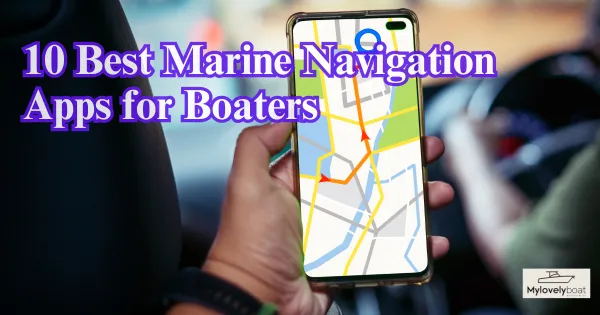
In the age of smartphones and tablets, marine navigation apps have become indispensable tools for boaters. Whether sailing across the ocean, fishing in your local lake, or cruising along the coast, an app is designed to meet your needs.
Below, we explore the 10 best marine navigation apps that have become favourites among boaters for their accuracy, user-friendliness, and innovative features.
Best 10 Marine Navigation Apps for Boaters
- Navionics – A Mariner’s Treasure
- iNavX – Navigate with Confidence
- C-MAP – Mapping the Future
- Garmin ActiveCaptain – The Connected Boater’s Companion
- Aqua Map – Your Waterway Pathfinder
- SeaNav – Augmented Reality at Sea
- SailGrib – Where Sailing Meets Science
- FishTrack – The Angler’s Edge
- Boating HD Marine & Lakes – A Virtual First Mate
- PolarView NS – Simplicity on the Waves
1#: Navionics – A Mariner’s Treasure
Navionics is widely recognized as a top-tier marine navigation app. It offers comprehensive nautical charts and sonar charts and a vibrant community of users who contribute valuable updates. Its “Dock-to-dock Autourouting” simplifies route creation, while map layers with real-time tide and weather data provide rich navigational intelligence. It’s a favorite among boaters for its detailed coverage and user-friendly interface, essential for safe and informed sailing.
2#: iNavX – Navigate with Confidence
iNavX is an all-around marine navigation solution compatible with various chart formats, including NOAA RNC and Navionics HD. This powerful app allows users to connect with marine electronics, offering real-time data such as GPS, wind speed, and depth. Its advanced features, like route planning and track recording, make iNavX a versatile choice for sailors who demand robust, professional-grade navigation tools on their mobile devices.
3#: C-MAP – Mapping the Future
C-MAP provides extensive chart data suitable for marine and lake navigation with impressive global coverage. It stands out with user-friendly features like “Custom Depth Shading” and weather overlays, making it an excellent resource for anglers and cruisers. Its streamlined planning tools and reliable chart updates ensure that mariners can navigate waters worldwide with ease and accuracy.
4#: Garmin ActiveCaptain – The Connected Boater’s Companion
Garmin ActiveCaptain serves as the ultimate companion app for Garmin hardware users, seamlessly integrating smart connectivity with chart plotting. It allows for effortless syncing of routes, waypoints, and even offers control over marine electronics directly from a mobile device. The community-fed data ensures users have up-to-date information, while smart notifications keep you informed in real-time, making it a must-have for Garmin ecosystem enthusiasts.
5#: Aqua Map – Your Waterway Pathfinder
Aqua Map stands out for its detailed waterway charts and navigational aids tailored to iOS and Android users. Its route planning tools and the “Aqua Map Master” subscription elevate the experience by adding USACE surveys, active Captain data, and advanced routing capabilities. Perfect for adventurers seeking to explore new waters, Aqua Map ensures navigators have valuable information at their fingertips for a safer and more enjoyable journey.
6#: SeaNav – Augmented Reality at Sea
SeaNav offers a unique navigation experience with its augmented reality feature, blending real-world views with vital navigational data. The app also boasts high-quality vector charts and a user-friendly interface. By simply pointing your device’s camera towards buoys, landmarks, or vessels, SeaNav provides enriched information, making it a top pick for sailors keen on integrating modern tech with traditional sailing.
7#: SailGrib – Where Sailing Meets Science
SailGrib caters to the needs of severe sailors and racing enthusiasts by emphasizing weather routing and optimal passage planning using GRIB files. The app calculates the fastest route using a vessel’s polar diagram and current wind models. Whether preparing for a regatta or planning a long voyage, SailGrib is an invaluable tool for those who seek to harmonize their sailing strategy with the forces of nature.
8#: FishTrack – The Angler’s Edge
FishTrack offers comprehensive tools for offshore anglers, providing satellite imagery, oceanographic data, and marine weather forecasts vital for any fishing trip. Features like sea surface temperature charts and chlorophyll maps allow users to pinpoint prime fishing locations with precision. FishTrack is indispensable for anglers leveraging technology to increase their catch rate and find the best fishing spots.
9#: Boating HD Marine & Lakes – A Virtual First Mate
Boating HD Marine & Lakes, by the renowned Navionics, is designed for a diverse boating audience. The app shines with its detailed nautical charts, auto-routing capability, and community-shared points of interest. It caters to everyone from kayakers to yacht owners, offering real-time weather data and chart updates, making it an essential navigation companion for leisure and severe marine exploration.
10#: PolarView NS – Simplicity on the Waves
PolarView NS focuses on simplicity and effectiveness in marine navigation. It combines chart plotting, tide prediction, and AIS integration in a clean, user-friendly interface. Ideal for navigators who appreciate uncluttered and efficient tools, PolarView NS supports seamless voyage planning and tracking. Its straightforward approach makes it a reliable choice for mariners who prioritize core navigational features without frills.
1. What is the best nautical navigation app?
The best nautical navigation app can vary based on your specific needs, but Navionics is often praised for its extensive features, which include detailed charts, autorouting, and community updates. It’s suitable for a wide range of boaters and available for both iOS and Android devices.
2. What is the most common navigation app?
Google Maps is the most common navigation app for general use. It’s widely used for its comprehensive and accurate mapping data, traffic conditions, and route planning for both driving and walking. For marine purposes, Navionics is among the most popular.
3. Which app is used for navigational purpose?
There are several apps used for navigational purposes. For marine navigation, apps like Navionics, iNavX, and C-MAP are commonly used. For terrestrial navigation, Google Maps, Waze, and Apple Maps are frequently utilized.
4. Can I use my phone as a marine GPS?
Yes, you can use your phone as a marine GPS by installing a marine navigation app like Navionics, iNavX, or Aqua Map. These apps use your phone’s built-in GPS to provide real-time navigational data on the water.
5. What is the best app for directions?
The best app for directions depends on the mode of transportation. For driving and walking, Google Maps is highly regarded for its accuracy and user-friendly interface. For marine directions, Navionics and Garmin ActiveCaptain are top choices among boaters.
6. What is the fastest GPS app?
The fastest GPS app in terms of performance and route calculation is often considered to be Waze for road travel, as it rapidly updates routes based on real-time traffic conditions. For marine navigation, apps like Navionics provide quick and efficient route plotting.
7. How accurate are smartphone marine navigation apps?
Smartphone marine navigation apps are generally quite accurate, as they utilize the GPS technology within your device which can typically pinpoint your location within a few meters. However, their accuracy can be influenced by factors such as the device’s GPS quality, the app’s chart data, and signal interference. It’s always advisable to have backup navigation tools when out on the water.